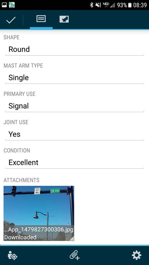
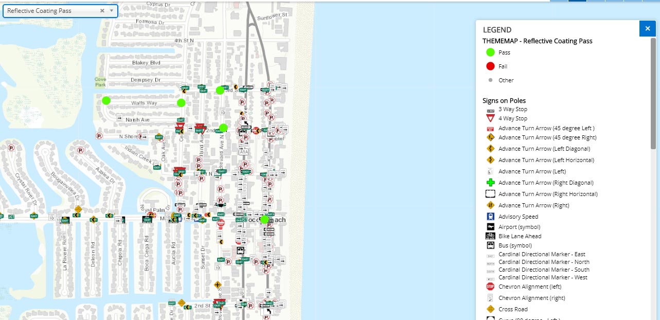
The SAM IS® Signs module aids collecting information and condition data about sign poles and faces, including data related to the Manual on Uniform Traffic Control Devices (MUTCD). This module assists with identification of the sign needs in your community, helping you to understand where you are under-compliant, and to create a plan to enhance safety and improve wayfinding for your citizens. In addition to standard MUTCD signs, the SAM IS® Signs module allows you to collect non-standard signs that are important to your community.
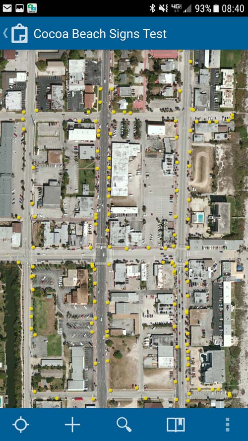
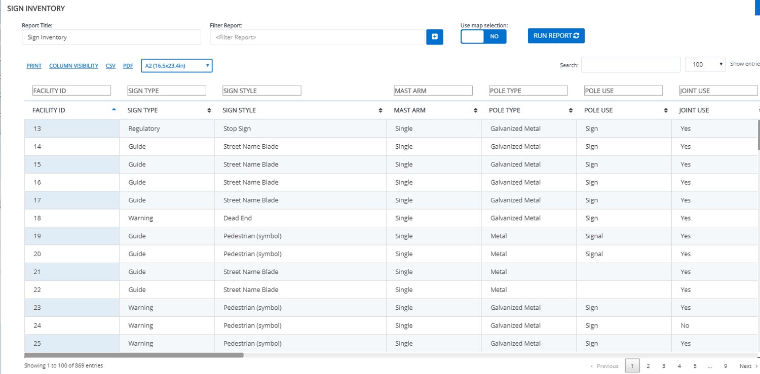
The field data collection capabilities of SAM IS® help you gather, store, and manage all sign and pole characteristics in a single online location, including photographs and other documents, such as drawings and permits. Whether signs are roadside, overhead, or on shared poles or mounts, the SAM IS® Signs module can help you analyze and communicate your inventory needs for budgeting.
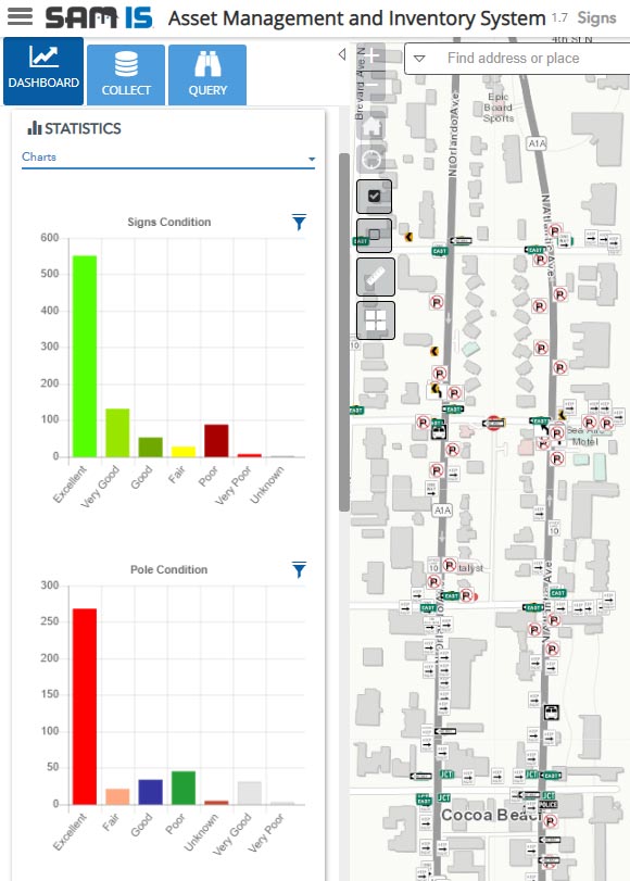
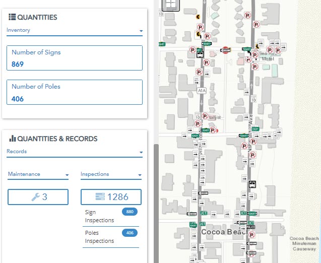
In addition to collecting many MUTCD-relevant fields, SAM IS® supports the gathering and use of sign retroreflectivity for planning and analysis. Its robust data can be used to properly understand replacement costs, coordinate inventory, and help confirm that current signage locations exist and are sufficient to meet your needs. Additionally, as you budget and schedule replacements, the module can be used to establish priorities based on sign type and/or safety importance. The SAM IS® platform uses Esri’s ArcGIS Online platform and works with your agency’s GIS data, so internal users can overlay other layers for a comprehensive view of planned projects or, potentially, analysis of area needs.